The Markers sub-pane serves for the definition of landmarks in the image.
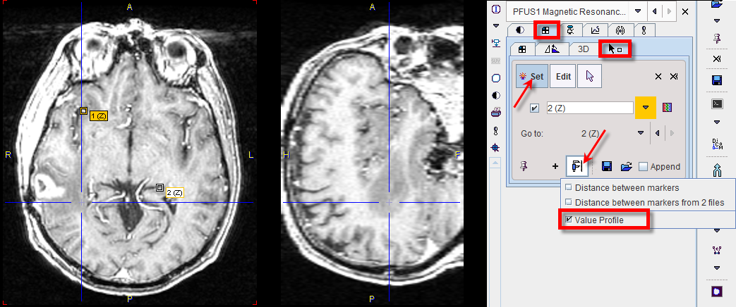
The best way to define landmarks is to operate in the orthogonal layout. If the Set button is active the user may click into an image to define anatomical landmarks which are shown as squares in the image. Using the + button, a landmark can be defined by entering its coordinates in a dialog window. To avoid marker generation, hold CTRL+SHIFT when clicking, or disable Set beforehand. The slices can be scrolled by the mouse wheel or by CTRL+DRAG. The spatial arrangement of landmarks can be saved for later use with ![]() .
.
The defined landmarks are numbered and organized in a list. The planes can be centered on a defined landmark by the Go to list selection. There are three types of landmark-based measurements:
▪Distance between markers calculates the distances between any two landmarks and shows them in a table.
▪Distance between markers from two files allows loading a second landmark set and calculating the distances between corresponding landmarks.
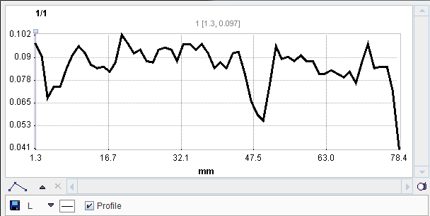
▪Value Profile generates a plot of the values between the landmarks, connecting them them sequentially with lines.